
130 runners wait for the start of the Hardrock 100 at 6:00 AM in front of the high school at Silverton, Colorado, elevation 9300 ft. The temperature is 37 F.
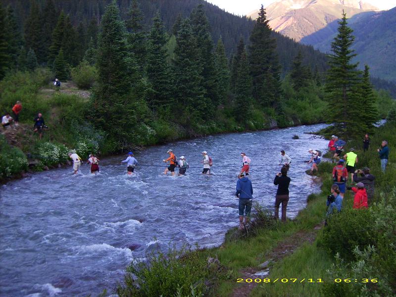
Mile 2, crossing South Mineral Creek.

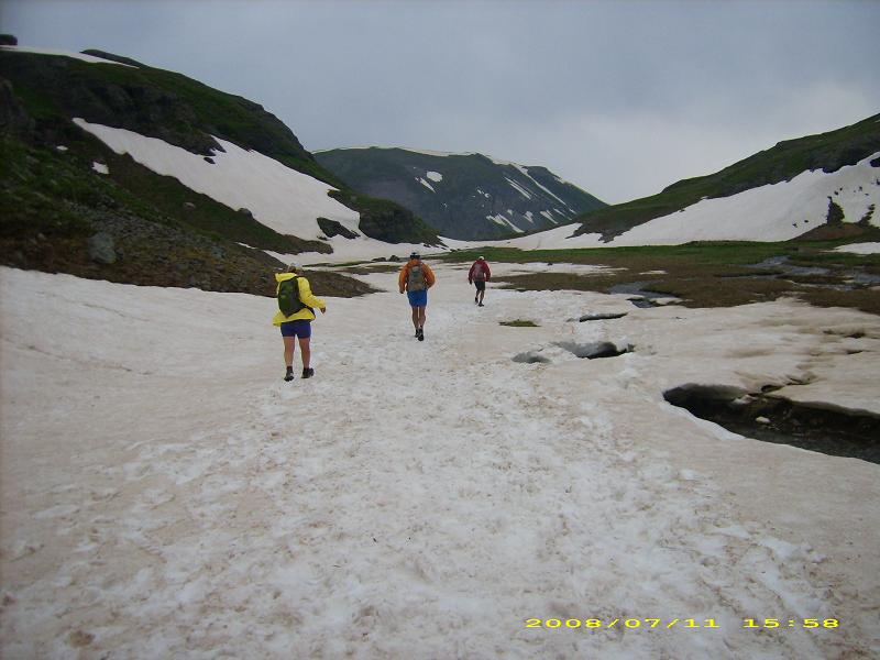
Mile 6, climbing Putnam Ridge near treeline (11,800 ft), the first of 11 major climbs.

Mile 8, top of Putnam Ridge, about 13,000 ft.

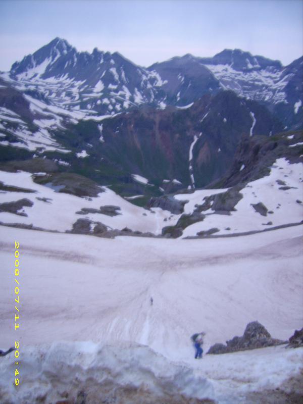
Mile 9, runners descending Putnam Ridge (looking back at specks on snow).

Mile 12, back down to 10,000 ft, approaching the first of 11 aid stations after 4 hours of running.

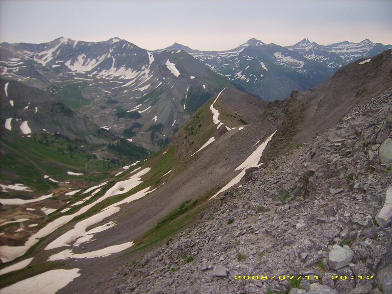
Mile 13. The Kamm Traverse crosses steep slopes above cliffs several hundred feet high.
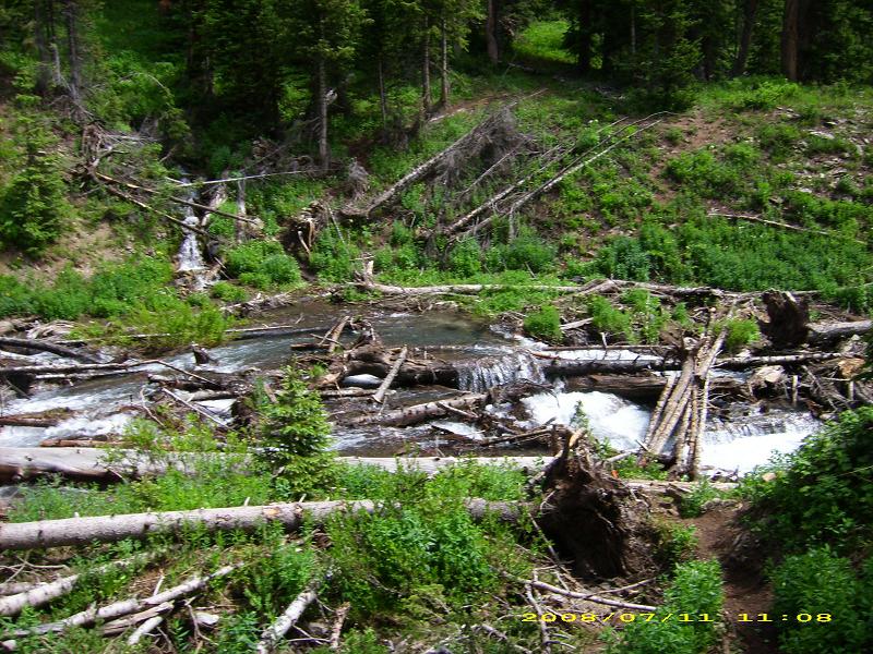
Mile 14. Cross the log bridge and climb the steep slopes on the other side.

Mile 15. Runners climb the "easy" side of 13,000 ft Grant-Swamp Pass above Island Lake.

Descending the "hard" (north) side of Grant-Swamp pass. The trail appears to end abruptly at a cliff, which confuses runners who haven't seen it before. Surely we don't go down THAT? Yes, you do. The preferred method is to butt-slide down 500 feet of dirt and rocks.
As if I don't have enough obstacles.

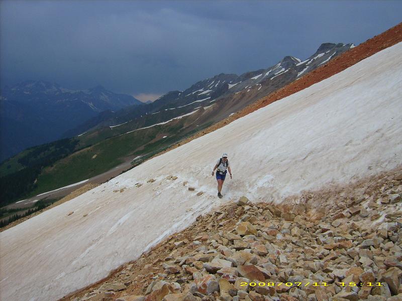
Looking north from Grant-Swamp Pass you can see the next climb up Oscar's Pass switchbacking 3000 feet in 2 miles up the next mountain range on the right side. Note runners on the snow below.
Mile 20. Climbing the Oscar's Pass jeep "road" near the 13,000 ft summit.
Mile 21. Start of the 4000 ft descent into Telluride.

Mile 25. Descending into Telluride, 8800 ft (aid station #3).

Mile 28. Looking back at Telluride after 1/4 mile. We continue climbing 4000 ft to Virginius Pass.

Mile 31. About half way up Virginius Pass around 11,000 ft.
Mile 35. Looking back at Mendoda Saddle from just below Virginius Pass, 13,000 ft.

Final climb to the "easy" side of Virginius Pass.

Mile 35. Kroger's Canteen aid station #4 on top of 13,000 ft Virginius Pass. It is getting dark.
You descend the first 150 vertical feet of Virginius Pass on a rope on a 45 degree snowfield. This is followed by two more glissades (butt slides on snow) without ropes for 500 vertical feet.

Mile 45. After Virginius Pass you descend a vertical mile to Ouray (7700 ft, lowest point on the course, and aid #6), then climb a vertical mile to Engineer Pass. Part of the climb is on a trail cut into a canyon wall with a 200 foot vertical drop. However you can't see much of it at night.

Mile 50. The Engineer aid station (#7) is packed in. Engineer Mountain is in the background. The 13,000 ft pass is just to the right of it.
Mile 52, 13,000 ft. Looking back at the Engineer aid station at the edge of the trees below.
